|
|

Canyons and Polar Caps
The northern plains of the Martian surface are separated from the southern
highland by a prominent cliff that can reach 2-3 km high in places.
The brightness of the plains is highly variable, reflecting the diverse
origin of the various smooth surfaces. Because of the lava flows and small
conic structures, it is believed that the plains most likely have a volcanic
origin. Dunes and wind streaks are also found in these areas, reflecting
the aeolian processes operating in an environment covered with loose materials.
These loose materials may have come from the deposits of the large flow
channels emerging from the southern highlands.
 |
 |
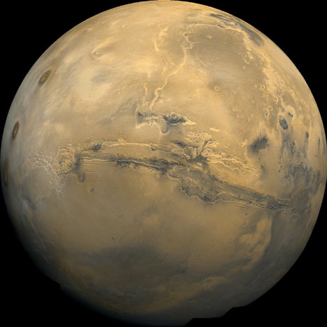
Close to the equator between longitudes 40 to 100 degrees west
is a vast system of interconnected canyons named Valles
Marineris. This entire canyon is about 4500 km (or 2800
miles) long, almost equivalent to the width of the continental
US. Because of its enormous size, the canyon is visible even on
a global view of the planet (Figure 1.8) . Individual canyons can
be as much as 200 km wide and 7 km deep. For comparison,
the Grand Canyon on Earth is only about 1.6 km deep. The
precise manner in which the canyons formed is unknown. It is thought,
however, to be a combination of faulting and erosion.
|
From telescopic observations, bright polar
ice caps of Mars can be identified. At the North Pole, there may be
a permanent water ice (as compared to carbon dioxide ice) sheet spread
over the surface. Carbon dioxide ice also has been detected in both polar
regions. Based on Viking observations, strong winds exist frequently at
both poles, most likely driven by large temperature variations between
the poles and the equator.
< back
1 2
3 4
5 6
7 next
> |